A Bug’s Eye View of Spring
Week of April 26, 2026 – May 2, 2026

by Anna Stunkel, Environmental Educator
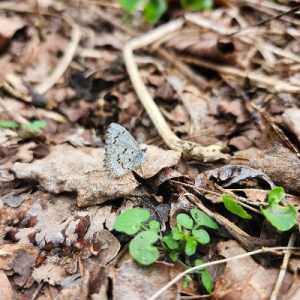
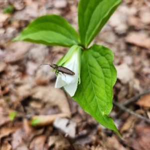
Have you ever looked really closely at the ground in spring? It can be carpeted with emerging life of all shapes and sizes, from tiny red mites to showy trillium blossoms and soft mosses. The leaf litter provides a safe and cozy place for animals to hide and an insulating layer for new plant growth as temperatures fluctuate. Webs of mycelium, slime mold, animal tunnels, and roots thread through the soil. Even in a mowed field, flowers are emerging, ants are hard at work, and worms are tunneling.
During our programs at Baltimore Woods, we often give people hand lenses or handheld microscopes to get a closer look at our findings. On a recent Nature’s Little Explorers outing, one of the kids was especially fascinated by using her hand lens. At times she was stopping every few feet to look at things, from gravel on the pathway to soft emerging leaves. Every finding brought excitement, even tiny pieces of bark! In our Nature in the City programs, students also find joy in exploring spring life on the ground. In this past week’s Journey of a Seed lesson at Webster Elementary, students delighted in finding “twirly bird” maple samaras and looking closely at bright green and red bud scales scattered in the grass.
As adults, taking a closer look at the ground can give us a child-like sense of joy as we discover things that we might have otherwise overlooked. Try marking off a plot of several square feet in your garden and tracking changes throughout the spring, or find a favorite spot at a local park or preserve. What do you observe with your different senses? Feel the texture of plant growth, listen to critters rustling in the leaves, look for different colored pebbles, and smell the scent of fresh spring soil. There can be a special sense of peace and focus observing these things alone, and a joy in sharing them with others such as children.
As we reflect on the beauty of the forest floor or the ground in any habitat, we can also think about ways to preserve it following Earth Day. You might help by planting native plant seeds, picking up stray pieces of litter, or leaving a layer of dead leaves in your yard to nurture the communities within. If you were a roly poly or a newly sprouting seed, what would you want your home to be like?


We invite our members to enjoy a weekly blog written by our naturalists. Every blog will be uniquely different but always inspired by nature. We may share a memory from a recent hike at The Woods or teach you about an animal or plant that lives on the preserve. No matter the topic, we will be sharing with you our passion for nature and celebrating the connections we all have to the natural world. Each blog will be connected to a weekly set of activities and ideas to help you put nature in your hands, even if you’re at home!

